

asfa
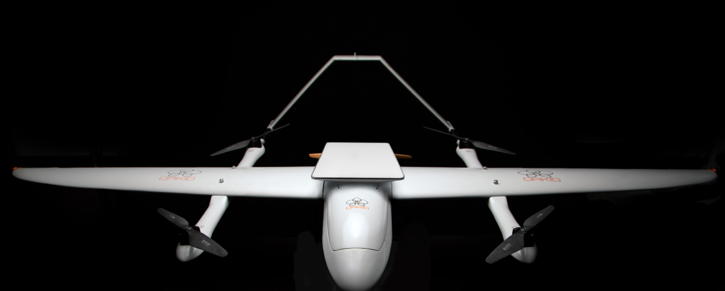
orkid 260vtol
surveying drone Variant
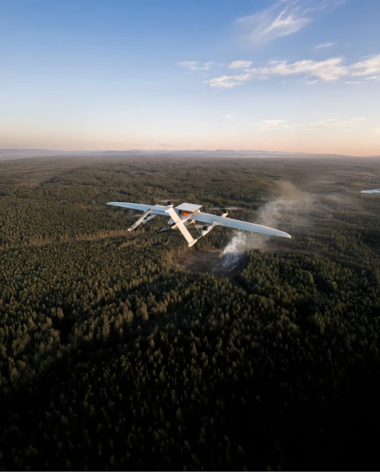
Precision Mapping Redefined with the ORKID 260VTOL Drone

001 – orkid 260 vtol – mapping Variant
( XXX )
The Orkid 260 Surveying Variant supports both photogrammetry and precision LiDAR payloads, making it ideal for applications ranging from corridor mapping and powerline inspections to infrastructure design and environmental analysis
Unmatched
Precision and
Coverage for Every
surveying drone mission
ORKID 260VTOL Drone surveying Variant
Delivering high-resolution data accuracy for applications in critical infraestructure, agriculture, urban planning, and more with the ORKID 260VTOL surveying Drone.
4.3
mm
GSD
55
m
SWATH AREA
80
mm
PIXEL BLUR
80
mm
FOCAL LENGTH
21
m/s
AIRSPEED
a01
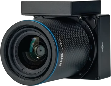
HIGH-PRECISION PAYLOADS SUBHEADING
Equipped with advanced imaging systems like the Phase One P5, the ORKID Mapping Drone delivers exceptional ground sampling distance (GSD) and swath accuracy. Its modular design also allows for seamless payload integration, enabling users to switch to high-precision LiDAR to enhance and complement a wide range of surveying missions
a02
OPTIMIZED FOR EFFICIENCY
Achieves 120 minutes of flight endurance and operates at 21 m/s, ensuring fast and reliable data capture for mapping drone missions.

a03
SEAMLESS AUTONOMY
Powered by intelligent cloud-based mission planning, the ORKID Mapping Drone enables fully autonomous mapping operations with unmatched precision.

a04
FLEXIBLE ARCHITECTURE
Designed to integrate advanced mapping payloads effortlessly, delivering unmatched versatility for diverse mapping drone applications.
Eyes in the Sky, Precision on the Ground
Empowering real-time intelligence with advanced optics for Cost-Effective surveying Drone Missions
[01]
Multiple Payloads, One Surveying Powerhouse
Choose between high-precision imaging systems like the Phase One P5—delivering 4.31 mm GSD, a 55 m swath, and minimal pixel blur for exceptional photogrammetry results—or the cost-effective Sony ILX-LR1 for dependable mapping performance. For missions requiring advanced terrain modeling or vegetation penetration, easily swap to our precision LiDAR payload to capture dense, accurate 3D point clouds. The Orkid 260 Surveying Variant is built for ultimate flexibility across mapping, inspection, and infrastructure applications.
[02]
Wide Area Coverage, High Detail
The Orkid 260 Surveying Variant is designed to capture large swath areas without compromising on precision. Whether flying over urban environments, agricultural fields, or rugged terrain, it delivers consistently sharp, high-resolution data across every frame. With optimized flight paths and advanced imaging or LiDAR payloads, you can cover more ground in less time—while maintaining the level of detail required for critical decision-making in mapping, inspection, and infrastructure projects.
[03]
Optimized for Speed and Stability
Designed for smooth, stable operations at 21 m/s and 100 meters AGL, ensuring optimal performance for high-speed surveying
[04]
Intelligent Mission Planning and Autonomy
Autonomous flight with cloud-based mission planning for seamless, efficient mapping operations

/003
Tech Specs
Tech
Specifica–
Tions
Tech SpecificaTions
ORKID 260VTOL
— mapping Variant
001
Max Speed
80 km/h (22 m/s)

002
Optimal Mapping Speed
21 m/s
003
Max Flight Time
150 minutes (with mapping payload)
004
Operational Range
200 km (BVLOS enabled)
005
Max Wind Resistance
12 m/s (Operational)
B00
High-End Option
B01
Camera
Phase One P5 System
B02
Ground Sampling Distance (GSD)
4.31mm
B03
Swath Area
55 meters
B04
Pixel Blur
0.73 (at 100m AGL, 21 m/s)
B00
Low-End Option
C01
Camera
Sony ILX-LR1
C02
Resolution
Cost-effective and reliable performance for entry-level mapping missions.
b01
C2 Link
Full Satellite Integration (LEO) – no ground infrastructure required, offering centralized, autonomous operations worldwide.


b02
Mission Planning
ORKID’s intelligent cloud platform ensures seamless mission planning, data collection, and analysis.

b03
Autonomy and Flexibility
Modular payload support with MAVLink-enabled functionality for easy integration and deployment.

b04
SATCOM
Integrated LEO terminal for encrypted, high-bandwidth, global connectivity; eliminates reliance on terrestrial radio infrastructure.

b05
Autopilot
NDAA-compliant NVIDIA Jetson V6X architecture for onboard AI inference.
b06
EO/IR
Simultaneous Real-Time EO/IR Video Streaming via SATCOM.
b07
Sensor Redundancy
Redundant GNSS, IMU, magnetometers for reliability.
b08
High-Precision Sensors
State of the Art Sensor Technology.
( xxx )
Applications
Overview
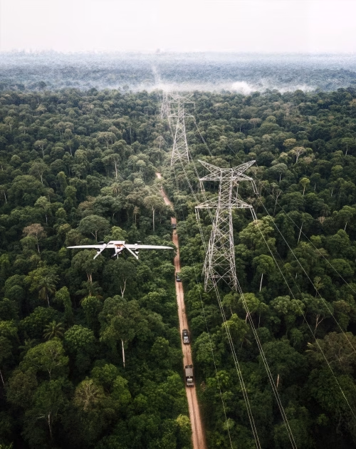
Power Line
Inspections
[ 001 ]
01
Key Sensors
Phase One P5 Camera (ultra-high-resolution mapping & imaging).
YellowScan Surveyor Ultra LiDAR (3D terrain & vegetation clearance models).
02
Outcomes
Fault detection, vegetation encroachment, digital twin creation.
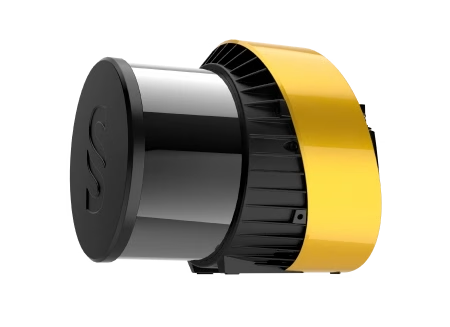
Phase One P5
Image sensor
Precision LiDAR
YellowScan Surveyor Ultra: Long Range LiDAR Scanner
Oil & Gas
Inspections
[ 002 ]
01
Key Sensors
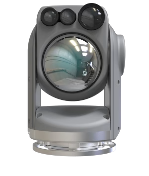
Next Vision Starling Camera (EO/IR gimbal for real-time video & thermal anomaly detection).
Phase One P5 Camera (detailed documentation and mapping).
02
Outcomes
Leak and threat detection, corrosion assessment, flare monitoring.
Next Vision Starling Camera
EO/IR drone camera for observation and reconnaissance.
Phase One P5
YellowScan Surveyor Ultra: Long Range LiDAR Scanner

Wildfire
Mitigation
[ 003 ]
01
Key Sensors
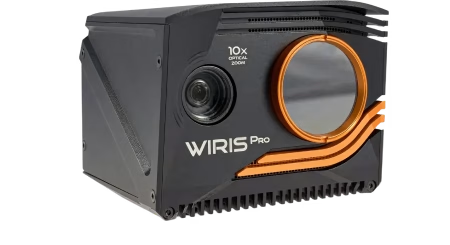
WorksWell Wiris Pro (high-resolution radiometric thermal imaging, 16-bit data).
02
Outcomes
Early hotspot detection, wildfire spread tracking, firefighter decision support.
WorksWell Wiris Pro
Thermal imaging
Long Distance
Surveying
[ 004 ]
01
Key Sensors
Phase One P5 Camera (ultra-precise aerial survey & photogrammetry)
02
Outcomes
Topographic mapping, land-use monitoring, infrastructure planning
Phase One P5
YellowScan Surveyor Ultra: Long Range LiDAR Scanner

/004
Geomapping solution
Setting new standards for geospatial data in agriculture, urban planning, and infrastructure
( 004 )
Elevating Drone Mapping Across Critical Applications
The ORKID 260VTOL surveying Variant is revolutionizing geospatial data collection and interpretation with modular payload options tailored to diverse project requirements. Whether equipped with high-resolution photogrammetry cameras or advanced LiDAR sensors, it delivers unmatched performance in even the most demanding environments.
Whether for precision mapping, agriculture, critical infrastructure, environmental monitoring, or urban planning, ORKID’s surveying variant delivers the flexibility, accuracy, and efficiency to empower impactful geospatial decisions.
Ready to elevate your surveying capabilities, ORKID delivers unmatched capability and efficiency.

( xxx )
Navigation &
Correction Services
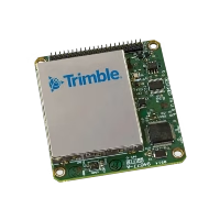
001
Trimble PX1-RTX for high-precision aircraft navigation and long distance flight
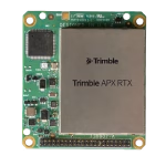
002
APX-RTX onboard for Phase One & LiDAR correction services
003
Benefits
- Centimeter-level Accuracy
- Reduced Need for GCPs
- Time & Cost Savings
/005
Get in touch
ready to elevate your operations?
(contact)
